
![]()
Home .
GPS .
Download .
Business .
Partners .
Contact .
Family .
AVL .
Links .
History .
AsOnTV .
Forum
GPS Software in Hot Air Balloons
Updated 1230 Thursday 13th September 2007 UK time

![]()
Home .
GPS .
Download .
Business .
Partners .
Contact .
Family .
AVL .
Links .
History .
AsOnTV .
Forum
GPS Software in Hot Air Balloons
Updated 1230 Thursday 13th September 2007 UK time

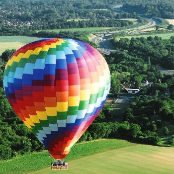
 Our three daughters gave me a 60th birthday present: a free flight on a hot air balloon for June and myself,
and on 1st September 2007 we made good use of it: a fantastic experience, thanks to
Tony of www.reach4thesky.co.uk.
It was receiving the ticket for this birthday present that re-awakened my interest in flying our GPS Software in hot air ballons, and so I moved the relevant software onto our Pocket PC version of GPSS. Further details are below.
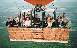
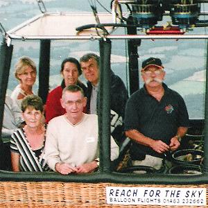 That's our pilot Tony, with the handlebar moustache - regularly sprayed with flame-retardent, and that's
us with fellow passengers, enjoying the ride. Yes, that IS twenty one of us on board, including the two man crew.
"Reach for the sky" was set up by Tony many years ago, and they are based just north of Guildford,
not far from us in Sunninghill, UK.
Needless to say, I just HAD to use this opportunity to test GPSSppc "in the air", including speaking altitude
above sea level and rate of climb or descent. We went up to over 2,400 feet - just into the cloud base :-)
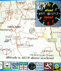 As mentioned earlier, that 60th birthday present re-aroused my interest in hot air balloons,
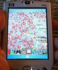
and so I moved the "sensitive area" logic from GPSS across onto the Pocket PC. For background,
please read the old words below, on this page, and the
Pocket PC and Smartphone pages.
On the left you see our recorded flight being replayed on the Mio GPS.
The data I have right now may not be the latest, but it may still be useful. You can
download the data, now suitable for use by the pre-release versions of GPSS (v6.6) and GPSSppc (v6).
This BALLOONS.EXE download includes the old files, but also the new format GPSSNOF.TXT which
is now in lat/lon instead of UK grid, to speed up processing on the Pocket PC. v6 of GPSS also
includes a [convert] button to convert from the old format GPSS.NOF to the new GPSSNOF.TXT and
$AN.GTX files. You may want to contact me before trying this data :-)
![]() DOWNLOAD BALLOONS.EXE from GPSS site (630,885 bytes)
- updated in June 2007.
DOWNLOAD BALLOONS.EXE from GPSS site (630,885 bytes)
- updated in June 2007.
WARNING : The Sensitive Area data above may be out of date.

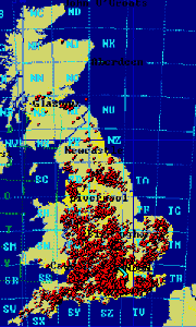 from May 2002...
Hi ! I'm Robin Lovelock. Most of the information on this page is really old - it was way back in August 1996 that the UK BBAC
Sensitive Area data was first made available for free use with GPSS, due to the good work of Derek
Belton - put in touch with me by Ian Ashpole. I see the last update to the page was
back in January 1999 - after the "Icicle" event mentioned below.
I'm making this update due to Geoffrey Walton kindly emailing me an updated GPSS.NOF set of UK Sensitive Area data. He suggests I also include a link to the BBAC web site www.bbac.org/affil/mhbc For the moment I've changed practically nothing in the old (italics) text below.
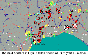 Before you download this self-extracting EXE of files, you should
get GPSS working on your PC via step 1 on the GPSS
DOWNLOAD Page.
If you have a Laptop PC and GPS you should then do step 2 (answer the Quiz) to get support from myself, including what mapping to add before adding BALLOON.EXE data above.
If you do not have a GPS, then you are welcome to browse the gpss.co.uk site and do the best you can. e.g. you will probably want to add UKWAW.EXE and UK99MAPS.EXE data from the UKDOWNLOAD page. Here are a few more tips, which will have to do until this page gets a proper rework :-)
- a circle radius 1 km around a Stud Farm, followed by a polygon of 4 points around the area of pedigree cattle. The 1.0 is a 1km radius circle, used by the GPSS warning logic, which should completely surround the polygon. The locations here are in UK grid, but could be in latitude longitude 15 character format. e.g. 513075N0012395W = N 51° 30.75 W 1° 23.95 You can edit GPSS.NOF with Word or Wordpad etc. It is a simple text file.
GPSS still seems to work with both the old and new copies of this
data, despite the many years in between. Maybe this is the time to
add a few more features to GPSS for balloonists ? Geoffrey has already suggested some :-)
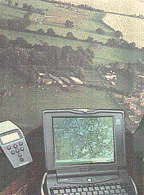
Over 3,500 'No Fly Areas' reported by British balloonists were incorporated within GPSS as data used to support the provision of an automatic map display and verbal warning. The areas are typically sensitive livestock such as horses, sheep, pigs (even the occasional ostrich farm !) that do not like big things hovering over them. Balloon pilots take care not to overfly these areas at low level, and use special maps with the areas printed on them. Ian Ashpole of Flying Pictures first 'flight tested' this software in the Samsung Balloon in the summer of 1996. The Sensitive Area data is collected by Derek Belton, and is available to members of the British Balloon and Airship Club - BBAC.
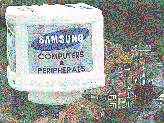
The world's largest computer monitor took to the sky for it's maiden flight in early July 1996.
Yes, it was the Samsung SyncMaster hot air balloon which measured an enormous 14.6 metres across and 14 metres high.
The Samsung Balloon carries a Samsung SENS800 multimedia Notebook PC which
'does the talking' using GPSS.
GPSS can also be used to 'play
back' flights recorded by GPS receivers such as the Garmin GPS, carried in the
balloon without a Notebook PC.

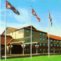 Over 100 balloons take part in this annual weekend event, this year on 9th and 10th January. Gale
force winds prevented flying at the 1998 event - but conditions were calm this year.
The balloon launch site was at SU248657, on the ridge just north of Warren Farm, marked as "The Warren", on the eastern fringe of Savernake Forest, about 14 miles south-east of Swindon.
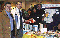 Many used the Hilton Hotel near Junction 16 of the M4 as their base. They hardly
needed GPS to guide them there - but for those that did, the grid reference is roughly SU100840. The 'balloon trade show' is held there and the hotel 'phone number is 01793 881777. Jose Ramos from Portugal and Robin mixed pleasure and business
on the Sunday. Here they are buying back issues of 'Balloons & Airships' from Pat Magee and Tony Beadle on the Kelsey Publishing stand. If you want to contact this magazine to discuss advertising or news, you
can call Chris Dunkley, the Editor, on Tel/Fax +44 (0)1296 624725.
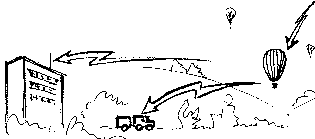 Paul Hough was to be demonstating some of his high tech gadgets - originally developed to track your car if it is stolen. These are explained on our 'car security & chase' page, but in summary : one or two balloons will carry special little 'Christmas parcels'. Each parcel will contain - suitably padded - a GPS receiver and radio transmitter (or mobile 'phone) This will permit the balloons to be tracked on the PC computer maps in the hotel - but also by the Receovery Crew 'on the road'.
Who knows - perhaps it may make suitable material for a Television programme like the Carol Vordemann 'Put It To The Test' broadcast earlier in the year ?


In 1998, Robin was contacted by other balloonists using GPSS in other countries as far away as New Zealand. The data above is only for the UK, but the software supports Sensitive Areas for any country - if someone does not mind the work of collecting the data :-)