 Home .
GPS .
Download .
Business .
Partners .
Contact .
Family .
AVL .
Links .
History .
AsOnTV .
Forum
Home .
GPS .
Download .
Business .
Partners .
Contact .
Family .
AVL .
Links .
History .
AsOnTV .
Forum
![]()
Home .
GPS .
Download .
Business .
Partners .
Contact .
Family .
AVL .
Links .
History .
AsOnTV .
Forum
![]()
This page is for the technical user who already has GPSS working with GPS on a mobile Laptop PC or Pocket PC. They will already done the Quiz on the download page, after getting the software working with GPS. They will have then used the key codes from Robin to register GPSS and add mapping from his web site.
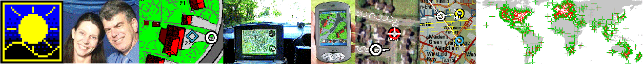
This page supports you making more detailed maps, down to "house level" detail - as you will see from the image below, which starts at Robin's home location in Sunninghill, UK.
Each GPSS map needs two files: the first is the map image. e.g. MYMAP.BMP - which might be made by copying the map image below via the clipboard [Print Scrn] key, for pasting into Paintshop Pro or Windows Paint for saving as a BMP image file. The second file, typically made by Notepad, is a text file which describes the map with information such as the south-west and north east corners. e.g. MYMAP.DES. If these two files are put into the GPSS folder the map will be used automatically. The file names (e.g. MYMAP) should be no more than eight alpha-numeric characters. Other ways of making GPSS maps are described on the mapimage and addmaps pages. See below the map for apologies, acknowledgements and Robin's request for help.
You can make maps for any part of the World: just use the map controls on the map below to select the map you want.
Then decide a short file name (8 characters or less): and title: and WAW file:
Here is the text to be cut and pasted via Notepad into
for testing: Mouse Latitude then Longitude ............ South West Latitude and Longitude .............. North East Latitude and Longitude
New experimental stuff here ... e.g. move the map to your own GPS latitude and longitude
GPSS Lat/Lon:
this is your GPS lat/lon as seen in low middle of GPSS screen.
![]()
 After a few hours of work, we now have something useful to make GPSS maps.
Of course, there is plenty of scope to improve this facility and make
it easier to use. I could use your help in testing - if you already use
GPSS or GPSSppc. If you are into Javascript, maybe you can help me with this page itself.
After a few hours of work, we now have something useful to make GPSS maps.
Of course, there is plenty of scope to improve this facility and make
it easier to use. I could use your help in testing - if you already use
GPSS or GPSSppc. If you are into Javascript, maybe you can help me with this page itself.
Sorry to any REAL Javascript writers out there. You can see the source html and script under your browser's FILE - EDIT WITH NOTEPAD or similar. I started by looking at the Javascript (VERY unfamiliar to this old man) used in the italian site, linked in past few years, from my mapimage page. Many thanks to Paulo of www.faureragani.it/mygps/getlatloneng.html.
What followed for me was then a painful process of searching for Javascript documentation and asking daughter Michelle to beg help from her friends. Many Thanks for this help, including simple things like SUBSTRING which I had not seen in my book. Here is a tutorial I found. If you think you can help - particularly if you are familiar with Javascript - you can contact me via our contact page.
I would much rather spend minutes, rather than hours or days, on this little project :-)
Robin Lovelock, Sunninghill in UK.
July 2010.
footnote from Robin in December 2010: Thanks to Daniel in Brazil for helping me see that Firefox does NOT yet work with this page as it should. I see that the map image appears OK but the DES file data does not appear when the mouse is moved over the map. Maybe Javascript experts can help me here ? This page could still be improved further. e.g. automatic saving of the BMP and DES files, and maybe even the automatic making of a number of overlapping maps to cover a particular area.
Even if you use Explorer, so that this page works, it may still not be easy to create that BMP file from the map image. You can use the [Print Scrn] key to save the screen image, but then you need to use an image editor package like "Paint" to crop out the 800 x 600 map image and save it as a BMP file. Even I was not sure how to do this with Paint ! :-)
Tip: if you use Paint, you can do Edit-Paste to retrieve the screen image. But you must then "cut out" the 800x600 map part to save. You can use the "select" tool, then use mouse to select the 800x600 area of the map. Then Edit-Copy, then "New", then Edit "Paste". Then "Save as" a 256 colour bitmap.
There are alternatives to Paint: For years I use a very old copy of Paint Shop Pro (PSP) and you can download it from psp1.exe. psp1.exe self extracts into PSP.EXE which you run from Windows. If anyone finds a simpler method, please tell me.
footnote from Robin in January 2011: thanks to Andrew Bullock - for showing me the minor change needed to make this page work with Firefox :-)