 Home
GPS
Download
Business
Partners
Contact
Family
AVL
Links
History
AsOnTV
Home
GPS
Download
Business
Partners
Contact
Family
AVL
Links
History
AsOnTV
Home
GPS
Download
Business
Partners
Contact
Family
AVL
Links
History
AsOnTV
Home
GPS
Download
Business
Partners
Contact
Family
AVL
Links
History
AsOnTV
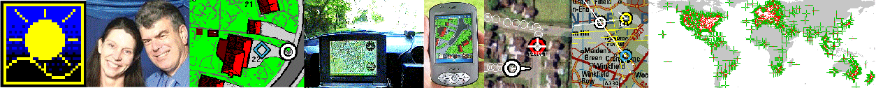
The following text is displayed by GPSS when the ? key is hit or the Icon in the low right corner is clicked. The user can scroll through the text which is shown in a blue window. He can also print out the text which is held in file GPSS.HLP - which is a normal flat text file. GPSS.HLP gives operating instructions, and explanation of what GPSS does, and conditions for use, including making copies of the software for others.
HELP for GPSS (Global Positioning System Software) Version 5.6 June 2004.
GPSS can be used in a Laptop-PC or Car-PC for GPS based navigation, or used to track
and communicate with multiple vehicles via radio, mobile 'phone or satellite systems.
GPSS is issued for free non-business use, as a means of contacting other businesses.
For the very latest news and detailed information about GPSS see www.gpss.co.uk
Click on logo above to remove this Help; again to remove logo. Use the scroll bar ----->
The Help screen is switched on with ? key or clicking on the icon in low right corner.
This Help text is in GPSS.TXT. Print with Notepad, Word, etc. or DOS PRINT GPSS.TXT
GPSS IS FOR USE 'ON THE ROAD', 'IN THE AIR' or 'ON WATER'
STRICTLY AT YOUR OWN RISK !
LOCATE THE COMPUTER WHERE THE DRIVER WILL NOT
LOOK AT THE DISPLAY OR BE TEMPTED TO TOUCH THE KEYBOARD.
ENSURE THAT THE COMPUTER CANNOT MOVE.
USE A SAFETY BELT.
Robin Lovelock regrets that he can take no responsibility for problems arising
from use of the GPS software, including road accidents or getting lost !
The speech output enables the driver to keep "his eyes on the road".
The map display is for passengers, or for use when the car is parked.
GPSS will run on any modern PC under Microsoft Windows 3.1, 3.11, 95, 98, 2000 or XP.
For more detailed information about GPSS, consult the web site www.gpss.co.uk.
A large quantity of mapping for over 148 countries is on the web site for
free download. For the USA, this free mapping goes down to street level.
Other data can be downloaded to make GPSS speak languages other than
English, including Russian, Japanese, Italian, Spanish, German, Dutch,
Swedish and Thai.
GPSS support remote, multiple vehicle tracking and two-way communication.
This is over a selection of communication bearers including GSM and other
mobile 'phone networks, radio, INMARSAT and ORBCOMM satellite systems.
For details of this please see www.gpss.co.uk/chase.htm
GPSS supports Geocaching - the "treasure hunting" hobby where people plant
hidden boxes of "goodies" with a logbook, and often a camera, then post an
accurate lat/lon and description on a geocaching web site.
Those that hunt down and find the box, write in the log book and append a
visit report, or "log", to the geocache description on the web site.
In May 2002 the known Geocaching web sites were geocaching.com,
navicache.com and geocachingworldwide.com. For the latest list of sites
and other information on geocaching, please visit www.caching.info
or www.gpss.co.uk/caching. Some local UK geocaches are already in $LGEO.GTX
under the G key. In addition to those planted by Robin and June, we now
have some from Tony, Richard and Scotty. If you have caches that you are
happy to regard as "Public Domain" information, please contact Robin.
We suggest you start by running GPSS 'hands off' to see what it can do. Then experiment
with the facilities described in this Help file, such as exploring the maps and
searching for places. Finally checkout the software with a GPS receiver 'on the road'
- but don't drive while you use the PC ! Much better if you get someone else to drive
for your first test.
If you do not want UNREGISTERED to appear on startup, you must Register. If you wish to
register with Sunninghill Systems hit Ctrl-R to display the Registration Form.
This should not be needed if you have purchased GPSS through a dealer.
BEFORE YOU SPEND ANY MONEY PLEASE CHECK WWW.GPSS.CO.UK
- registration and support may still be free in your country :-)
Robin Lovelock, Sunninghill Systems,
22 Armitage Court, Sunninghill, Ascot, Berks SL5 9TA, UK.
NOTE THAT THIS REGISTRATION IS FOR YOUR OWN PRIVATE USE,
RUNNING GPSS IN A PC DIRECTLY CONNECTED TO A GPS RECEIVER.
Other uses, such as business use, or use for remote tracking, requires a
special licence. If you have an e-mail or fax number please provide it, or
enclose an addressed envelope. We will send back the key code which will
enable you to change the UNREGISTERED message displayed on startup.
Robin Lovelock will often grant free registration to those helping him
test GPSS, or develop new business based upon the GPSS product.
Many of the user functions of GPSS can be triggered from a single keystroke.
This means they can be tested, or even used, with only a keyboard on the GPSS PC.
Configurable logic permits icons to be linked to keystrokes (e.g. for touch screens),
or keystrokes to be converted (e.g. for smaller, special keypads).
GPSS can be used with voice recognition (or simply the keyboard) to request information
or control the computer. e.g. tell it to be quiet ! For speech input just set the voice
recognition package up to emulate these keystrokes in response to spoken commands.
If you want to spell out place names, you will also need the alphabet, "A", "B", "C",
etc. Not all of the following need to be enabled and used. These keystrokes (and
suggested voice commands) are:
Key Voice Command Effect
? "Help" switches this HELP screen on or off.
A "Pardon ?" (Again ?) ask computer to repeat last phrase
B "English" (British) switches to English.
C "Whats the Time" (Clock ?) tells you the time.
D "Destination" makes found place the destination for guidance.
E "Eating place ?" select eating places for search (in $E.GTX).
F "Filling Station ?" select petrol filling stations ($FS.GED)
G "Geocache ?" select Geocache locations in $LGEO.GTX
H "Home" make Home the destination.
I "Interesting Place ?" select Interesting Places ($LNTEH.GTX).
J "Jump Language" switches to Japanese, or next in LANGUAGE.CFG.
K "Real" (Keep) to real position after use of "Visit".
L "Location ?" tells you location in Grid or Latitude and Longitude.
M "Tell me More" More information on found place if available.
N "No" in answer to question from computer.
O "OK to speak" controls what computer will say.
P "Population Centre ?" nearest Population Centre ($LPOP.GTX).
Q "Quiet" the computer will only speak when spoken to.
R "Railway Station ?" select railway stations ($LR.GTX).
S "Sleeping Place ?" select hotels ($S.GTX).
T "Traffic ?" reserved for Traffic. Currently for Tiger Test.
U "Units" switches units between miles/yards & km/metres
V "Visit" visit selected place by car (indoor simulation)
W "Where are we ?" tells you where we are, and progress to destination
X "Zoom in" Selects (eXtracts) most detailed map (smallest area)
Y "Yes" in answer to question from computer
Z "Zoom" Changes scale of displayed map (bigger area)
(Enter) "Search" Search selected data for nearest, or next nearest place.
Control-Enter - "Super Search" - find the 20 nearest places (ahead if moving).
Ctrl-A Display Analysis Form to control playback of recorded data.
Ctrl-B Display Banner showing Version number, etc. (the "little dog")
Ctrl-C Display Experimental Facilities including demonstrations.
Ctrl-D "Remove Destination" Removes the destination (square symbol)
Ctrl-E End the Simulation or Demonstration reading from GPSS.NME
Ctrl-F "Freeze" - Pause recording started with % key.
Ctrl-G select GPSS Users for search ($LGPSS.GTX if available).
Ctrl-H Hide GPSS display
Ctrl-I Input location as Legal Sub-Division code (LSD) - Canada.
Ctrl-L Learner Driver mode (if supporting data available)
Ctrl-N Multi-Vehicle tracking mode.
Ctrl-O in-Car mode.
Ctrl-P toggle (Phone) dialup form.
Ctrl-R Display the Registration Form needed to suppress Snoopy.
Ctrl-U Sequence output through lat/lon, UTM, Military Grid formats
Ctrl-V move information to bottom of screen on high res. displays.
Ctrl-W Waypoint to GEO file
Ctrl-X Zoomin map from largest map.
Ctrl-Z automatically enlarge maps to fill screen.
0..9 (any name) select place from those in GPSS.LOC. 1=first, 2=second,etc.
/ "Car" Switch search location between car and destinatiion
+ "Next" Next category of geographic data selected
- "Back" Last category of geographic data selected
` "Find" Start entry of a name to search for (e.g. a town)
(followed by text of name ended by (enter)/"Search". e.g. `ascot)
(or followed by a GPS update to GPSS.LOC. e.g. `3 or `3 Freds Home)
(or followed by a latitude and longitude. e.g. `523050N0033050W)
(or followed by a UK grid reference. e.g. `SU123567 enter)
(or followed by an Irish grid reference. e.g. `A123567 enter)
(or followed by a UTM grid reference. e.g. `32U526057740)
(or followed by a bearing for triangulation. e.g. `045)
^ (shift 6) "GPS" displays GPS Engineering Information in a window
including direction of satellites being tracked
& (shift 7) "Test" Switches in and out of Speech Input / Keyboard test
( (shift 9) "Save" Saves configuration data in .CFG
) (shift 0) "Automap" Toggles Automatic Map Selection on and off
_ (shift -) "Instruments" Toggles display of Instrument Panel
. "Reset Tacho" Reset the tachometer on Instrument Panel
% (shift 5) "Log" Toggle logging of GPS data to NEWTRIP.NME
(NEWTRIP.CFG holds AAAAA, making % log to AAAAA001.NME then AAAAA02.NME)
(Edit NEWTRIP.CFG to make it log into other files. e.g. JOHND001.NME etc)
* "Demo" Switches to demonstration mode
Space "Again" Repeats last input command from operator
\ "Platform" Switch use between Car, Balloon and Aircraft
' "Altitude ?" Ask for GPS based altitude
# "Airfield ?" Find nearest airfield known to GPSS
] "Hazard ?" Find nearest hazard known to GPSS
> "Faster" Faster Playback of recorded data
< "Slower" Slower Playback of recorded data
@ "Controls" toggle Icon Controls (switched on by click on low display)
| (shift \) swich off the demonstration by forcing to 'OLD' state.
(Esc) Escape for "More Information" or Exit from GPSS.
The following facilities are for Robin's use and are subject to change:
! Toggle map rotation on or off
$ switch on automatic map server, such as SAD.EXE
`SHOWMAPS plot map coverage and create a summary of maps in SHOWMAPS.TXT
`/WAW plot towns in the current .WAW file and check existence of sounds
`/(townname) add town into NEW.WAW. Position at Destination, Edge at Car.
`NMEA switches mouse input to append simultated NMEA data into NEW.NME
`#L,, (or other category followed by ,,) start generation of NEW.GTX
`#(name) define the name to be enclosed in ## into NEW.GTX
`# end this map data generation mode
`DFBRGREL toggles DF bearings between absolute and relative
`RGI+ monitor RGI process
Click on controls at low centre for the touch keyboard,
for Car-PC with touch sensitive screens.
A GPS receiver, with a 4800 baud RS232 NMEA interface will also be needed, if you want
to use this software `on the road'. These cost from 50 pounds (80 USD) and the GPS
service is provided free by the United States Government.
Please see www.gpss.co.uk/wheregps.htm for advice on where to get a GPS.
The GPS receiver connects to COM1 or COM2 (specified in GPSS.CFG).
If the software cannot open the specified port it will set it to NULL.
The ^ (shift 6) key switches on the 'GPS Engineering' display - to show COM port data.
GPSS Configuration Files: Many facilities within GPSS are "hidden"
and only made available for specific applications. e.g. remote tracking.
Many of these features are made available with configuration files.
Here are some common ones that are not secret:
METRIC.CFG any file with this name makes GPSS start in km/m, not miles/yards.
DIALS.CFG - starts up with Instrument panel on.
GPSS.CFG - can be edited to change default GPS COM port, home location, etc.
CONDITIONS OF USE:
This copy of GPSS is called "Free" because you may have obtained it from
www.gpss.co.uk, a friend, or a free CDROM. You may not sell GPSS for profit.
This GPSS software is the copyright of Robin Lovelock. The concepts demonstrated
in this software are the Intellectual Property of Robin Lovelock.
You do not need to register or pay for use of this copy of the software,
but please respect the following conditions of use:
You may copy and distribute the two floppy disk "baseline" of this software
to others in its complete and unmodified form on two floppy disks.
You may not put this software on the Internet.
You may add maps and other data for your own experimental use.
You may give, but not sell, this other data, on a third disk, to others.
None of this software is to be sold.
The software is not to be decompiled.
You may not use any of the files for another purpose than with GPSS.
Any deletion or modification to data files must not be passed to others.
GPSS must not be demonstrated to others in the context of business development without
permission from Robin Lovelock. This permission is sometimes granted at zero cost.
GPSS is distributed as a means of contacting businesses who can exploit it.
If you are someone with a business interest, visit www.gpss.co.uk/ifyouare.htm
You can still run the software, even if you don't have a GPS receiver.
The program will start by trying to open COM1 for input (specified in
file GPSS.CFG). If it cannot open COM1 it will use NULL.
It expects to receive NMEA format GPS data on this serial port.
GPSS operates in several `modes' indicated in the lower right corner flag:
DEM - `demonstration mode' when the program starts.
SIM - `simulation mode' if an operator mouse or keyboard input is received.
GPS - real information when data is received from GPS.
OLD - if GPS data ceases to arrive.
<- - `pointing mode' if the operator is moving the mouse.
If no data is received it will switch to 'demonstration mode' using a journey
'that I did earlier'. When in demonstration mode it will simulate operator
inputs (you will hear Michelle's voice). Any real input will cause a switch
to 'simulation mode': GPS is simulated but not the operator inputs.
It will switch to 'GPS mode' if GPS data is received. Loss of GPS data
will result in 'OLD' being displayed.
Movement of the mouse will pause update of the GPS (or simulated) data
for 10 seconds, giving you the opportunity to display Grid and Latitude
and Longitude co-ordinates of the mouse pointer on the available maps.
Destinations can be chosen by:
1) clicking on the destination list.
2) clicking on a map (left button).
3) searching for a place then selecting it as the destination.
Voice instructions are then given to guide you to the destination every 20 seconds.
Your position is described relative to major towns or landmarks every minute.
clicking on a destination gives a similar verbal description of its position.
The right button can be used to move the car (circle) symbol to a new location.
This can be used when 'exploring' maps indoors or to apply a GPS correction.
This facility is only available after you switch off the demo with Control-C page.
You can request the computer to search for places nearest the car position.
e.g. the nearest Petrol Filling Statiion, Eating Place, Sleeping Place, etc.
This can then be chosen as the destination for voice guidance.
Hit H for Home (specified in GPSS.CFG) as the new destination.
The baseline copy of GPSS, capable of being compressed onto two
floppy disks, provides non-detailed mapping over the whole UK mainland,
and more detailed sample maps for demonstration. More detailed maps
can be added from www.gpss.co.uk for the UK and over 137 countries.
Street level maps for all the USA may now be downloaded from www.gpss.co.uk.
The following are details of sample maps within the GPSS Baseline:
Digital mapping such as that in BRACKNEL.BMP is available from Bartholomew.
Bartholomew also market a range of raster images, including both `road atlas'
and `atlas' styles for many areas of the World. For more information contact
Duncan Pickering at Bartholomew on tel. 01242 258134 fax. 01242 222725.
The GPSS Baseline includes sample UK data: over 3500 petrol filling
stations, 1000 towns, 850 eating places, 200 sleeping places and
700 interesting places to visit like National Trust sites.
We welcome BUSINESS contact by post, fax, or e-mail. We prefer e-mail.
Sorry that we cannot provide telephone or fax support to the end-user.
Sunninghill Systems,
22, Armitage Court,
Sunninghill, Berks.
SL5 9TA.
telephone/fax: 44 (0) 1344 620775.
e-mail: gpss@compuserve.com
Businesses should start by visiting www.gpss.co.uk/ifyouare.htm
The main reason why Sunninghill Systems distribute the basic GPSS package free,
and sometimes grant licences and 'Snoopy Suppression' keys at zero cost, is to
contact businesses who can exploit the GPSS.EXE core product. This is where we
earn revenue - from those who use it in mass market products, or higher value
applications such as multiple vehicle tracking. Whether you are a large
corporation, or simply someone thinking of starting their own business, maybe
we can help each other in some way. E-mail me after visiting www.gpss.co.uk,
or give me a call. The telephone is for business enquiries only.
I would like to thank all those who have assisted in the provision of sample
map data, the loan of hardware for 'road testing', or simply provided advice.
I would also like to thank my friends in many countries, for help in testing.
Enjoy the software, but PLEASE DRIVE SAFELY.
Robin Lovelock
June 2004.